Sunday 31 July 2011

Post 25: Sunday 31 July, having a rest day in Missoula, Montana

Missoula is big, with a population of 57,000. So the ride in yesterday was a culture shock! - I had started the day in Darby, a one street town with 710 residents. And now I am in a city with affluent streets and houses.

A lovely suburban house in Missoula

Missoula County Court House


 But Montana has continued very beautiful.

A craggy gorge on the Bitterroot River
 And I have been blessed by wonderful weather; the last few mornings have been cloudless, and the colours - the lush green of the irrigated hay, the darker greens the trees, the yellow/brown of the parched scrublands higher up the slopes, and the blues, streaked often with white snow, of distant mountains, have been breathtaking.

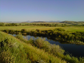
The Bitterroot River, near Darby
(I have learnt that the irrigation in some places is to permit a third cutting of hay this summer; Montana hay is high quality, and some Kentucky race-horse stables will come here to buy their hay supplies.)

So I greatly enjoyed cycling along the Big Hole Valley basin, out of which I climbed to Chief Joseph Pass, my ninth and last crossing of the Continental Divide.


 From there (at 7200 feet +) I have now dropped to little more than 3000 feet in Missoula. One obvious difference at the lower altitude is seeing deciduous trees again; I had grown used to a visual diet of conifers for days and days. Another difference is that it is much hotter down here....

I am now in the Bitterroot River valley, which began as a gorge but is now a wide glaciated basin like those I have recently been through. The flanking mountains, though, have stayed close, giving good views of the steep valleys up to the peaks - at 9-10,000 feet - with the snow still lingering on some.

The Bitterroot Mountains, South of Missoula
 Chief Joseph was a chief of the Nez Perce Indians. On my way up to the Pass I visited the site of Big Hole Battlefield, which is now a National Historical Site, and done very well as such places always are. The battle was an engagement between Nez Perce Indians and US forces in 1877. In summary, the US authorities revoked a treaty with the Nez Perce signed earlier, which had restricted the Nez Perce to a particular area in the NW, pretty much where their ancestral homelands were, for hundreds of years, maybe thousands.... The reason for revoking the treaty was that gold had been found, in the lands safeguarded for the NP, and settlers, stockmen and miners regarded it as their 'Manifest Destiny' to move onto Nez Perce land. Some NP, but not all, signed a new treaty reducing their lands by 90% (yes, 90%!). But many NP did not regard themselves bound by that, and friction turned to hostilities. One group of NP were trekking towards the area assigned to them, but later than required, and US troops were pursuing them to force compliance. The 'battle' at Big Hole River - according to the video I watched - began as a massacre; the US soldiers surrounded the NP camp in the early hours, and when one Indian was in danger of discovering them as he went to check on the horses, they shot him then opened fire into the camp, firing into the Tee-pees, and then setting fire to many of them, and mainly killing women and children. Some of the NP warriors were able to regroup and inflicted big losses on the troops. But the upshot of this 'battle' was that many NP reckoned they could never feel secure in the US, and trekked to Canada.

I found it a very disturbing story, as I had found the story of the Sand Creek Massacre back in Kansas (at much the same time). I brooded on it as I cycled on.

I have commented in this Blog that they do their historical things very well here. But the perspective is often purely white man's history ignoring what happened for centuries before. One information board I read recently beside the road pointed out that one tribe, the Salish, had probably lived in that area for 8000 years....

Anyway, let me get to more prosaic topics.

It has been fun to meet up with more cyclists in recent days. Paul, from Illinois, is a teacher whose wife allows him four weeks each summer to go touring. We had breakfast together in Wisdom, and I learnt a lot from him.

I also met (because I encountered them on the road mending a 'flat') two ladies on a short three day tour, and we had a fun dinner together later that day.

Then in Darby, two evenings ago, coming out of my cabin-room, I was hailed by 5 guys from Cincinnati, Ohio, who cycle together each summer for two or three weeks; they are sort of doing the TransAm in stages. They adopted me for the evening, and it was fun to talk bikes as well as an opportunity for me to learn more about the US generally. Such chance encounters are one of the real joys of touring!

My daily eating habits have evolved into a routine - if circumstances permit. I like to have oatmeal (=porridge) and toast and tea for breakfast, either in my motel (if it's provided), or in a cafe. (Sometimes cafes provide breakfast from 6 am.).

Then, though - if there is a restaurant or cafe at the right time - at around 10, I like a second breakfast, perhaps an omelette (=protein) and toast. I had a wonderful omelette yesterday in a beautiful cafe called "Memories" in a tiny place called Corvallis.....

Memories cafe, outside...
... and inside


Or, if that's not possible, but there is somewhere to eat at around noon, then a toasted BLT sandwich and iced tea goes down well! (Iced tea here is called simply "tea"; English-type tea is known as "hot tea"!) As well as these more substantial refuelling stops, I also stop to snack from my own supplies every 10 or 12 miles: baby doughnuts, choc chip cookies, energy bars, 'trail-mix' (=mixed nuts and dried fruits) or whatever.

And then my evening meal will have as much pasta or rice as possible! But no, I am not yet getting fat!

I have to confess, though, that I am now feeling cumulatively a little weary, and part of me would simply like to finish. Perhaps not surprising after 3,400 miles.... 12 more cycling days (and one more rest day, after today), along my revised 'northern' route, including the Northern Cascade mountains in Washington. It promises to be very beautiful, again. Then I should get to Anacortes on Saturday 13 August. Roll on, both my wheels and the time!

I know some readers think I'm a bit crazy. But my friend Steve Lant (from Newcastle) has told me of a Geordie guy who is running across the States, from California to New York City, aiming to do it in 100 days (31 miles a day). So far he is a bit behind target but has done 90 days - would you believe?! - and has 410 miles to go. Now as an adventure or challenge that is crazy beyond belief!! (He has a website/blog: www.rungeordierun.com )

Two more noteworthy names to share with you: a local Montana beer is called "Moose Drool" - appetizing? Not sure..... But this roadside advert which I saw yesterday must take the prize!


With best wishes, and continuing thanks for your interest and support,

Ken
Early morning shadows

Thursday 28 July 2011

Post 24, 28 July, from Wisdom, Montana

Dear all

I have now had three days riding in Montana. It is stunningly beautiful! I am constantly amazed.

Wide views, wide skies
 This SW corner of the state is characterised by hugely wide river basins - reminiscent of South Park and North Park which I loved so much in Colorado. The valley floors grow hay, which this year - after such a wet winter and spring - is bright green, but intermixed with wild flowers.

Almost an English cottage garden!
 Then further to the sides, usually on the moraines left by the glaciers, the sparser grasses are yellowy brown. Then beyond them, the mountains rise either side several miles away - often with traces of snow. And as I ride through these valleys, wherever I look is supremely beautiful....

Ennis main street, early morning
Yesterday morning, leaving Ennis, I climbed away from the beautiful Madison River basin, which had given me such great cycling for a day and a half, and for 80 miles or more.

Last view of the Madison River basin
The route then went along a narrow valley called Alder Gulch, site of a frantic gold rush in the 1860s. Two towns sprang up, boomed, and died, but they have been reconstructed and preserved, so that their Main Streets are now like a living museum.

Virginia City, preserved gold town
One of the original dredging machines lies in a pool by the road side. Where they operated, the dredgers literally turned the valley upside down, and the piles of dredged gravel are still very visible.

One of the gold mining dredgers
 Then lovely riding in another wide basin, this time along the Beaverhead River. (Beaverhead Rock was an importantly prominent landmark on the Lewis & Clark Trail- a bit like Split Rock on the Oregon Trail in Wyoming).

Beaverhead Rock
 Today has been similar, though with the challenge of two long climbs to the delightfully named Beaver Pass and then Big Hole Pass. (The French apparently called these wide valleys 'grands trous', and here the name has stuck!).

Big Hole valley
 At the top of Big Hole Pass I was rewarded with a magnificent view of the Continental Divide range in the Rockies, with high snow-clad peaks. It was another major "Wow!" moment, like the first view of the Tetons.....

Snow on the Continental Divide Mountains
 Tomorrow I cross the Divide, for the ninth and last time (no less - I feel as though I have been living in the Rockies, but you can tell I'm not complaining!). Psychologically, though, I will feel good knowing I am heading for the Pacific.

One bonus yesterday was meeting up with two couples both doing the TransAm Trail west-bound. Wendy and Graham are semi-retired New Zealanders, and Olive and Ben are from Seattle, have just got married, and this is their honeymoon! I rode with them for several hours, and as we chatted the miles rolled by very easily. Good company!

Wonderful colours in the Beaverhead Valley basin
 What else to share?

Well, at the risk of appearing to be a grumpy old man, to someone used to British caravans (and British fuel prices!) the sheer size of American 'RVs' ('recreational vehicles') is amazing, even ridiculous.


 Some are like articulated trucks, towed by big pick-ups; others are the size of 30-seat coaches. The latter often tow large 'SUVs' ('sports utility vehicles'), so that when they get to their campgrounds they can go driving some more.... And the SUVs sometimes themselves have bicycles on rear racks. It all seems to be a statement saying, "Look at me, I love the outdoor life!". Yet many RVs have a/c, flush toilet, separate rooms, and even satellite TV. Basically it's like taking their home with them!

Something else continues to surprise, even shock, me. Walking into a sports shop in Ennis, it was a shock to see rows and rows of hunting rifles for sale. When I asked the shop lady if I could take a photo, I explained that guns simply weren't part of our culture in Britain. She was as surprised by that as I was by their availability....

Guns for sale, it continues to shock me
 Another cultural thing: tipping in restaurants and cafes. Gary alerted me to 20% being the norm for good service. And I must say service here usually is good. But 20% adds hugely to costs when one eats out just about every meal. And the waitresses sometimes take it for granted. Having a second breakfast the other day in a sort of resort lodge, with Manny, our young lady waitress was hopelessly slow and forgetful. My bill was $5.30; I had no change so gave her a $10 bill, and she had the gall to ask if I "needed" the change!!

This Post isn't meant to be a catalogue of complaints; far from it - there is very very little I have to complain about. As I have often said, the vast majority of people I meet are kind, open-hearted, and intrigued my my loopy adventure.

No odd names to share this time. Some of the mountain and valley names are enchanting: 'Hangman's Gulch', 'Old Baldy Mountain', 'Sunrise Peak'.

I did stop and stare at a car licence plate for Idaho. State licence plates often have a slogan; Idaho's claim to fame seems to be "Famous Potatoes".... !
More in a couple of days, probably from Missoula, MT.

Till then, all best wishes to all,

Ken

Tuesday 26 July 2011

Post 23: Tuesday 26 July, from Ennis, Montana

Dear all

Montana's nickname is Big Sky Country
 Apologies for the radio silence since Muddy Gap last Wednesday. Since then I have had five long riding days, averaging nearly 80 miles each - and during two days I had significant headwinds. These factors have meant late arrival at my destination each evening, leaving no time to catch up on this Blog.

Looking South down the Wind River
 The corner of Wyoming I have been through is renowned for its winds. For more than a day I followed the Wind River (with the mountain range of the same name alongside). I now understand how it got its name! (And, when I mentioned the wind to a guy in a convenience store, he said "That's why we all have same hairdo!".....)

Indeed I have coined a new verb: to "wyome" (noun: "wyoming"); definition, to struggle against a headwind.....

Snow on the Wind River Mountains, seen from Beaver Rim
 Wyoming may appear welcoming and hospitable in the summer. But folk tell me the winters are harsh, with long periods of very low temperatures, and much snow - which, where it is windy, creates huge drifts. A lady cafe owner told me they have 600 inches of snowfall a year (I make that more than 15 metres - but she added that the snowploughs keep the roads open, and school kids simply don't have 'snow days' off!). It can snow even in late June and did so this year, which is why there is such a wonderful profusion of wildflowers along the roadsides and in the grasslands. They add yet another ingredient to the beauty around me as I ride....

Green meadows and the Tetons
 Indeed each recent day has been spectacularly beautiful. The Wind River valley became more lushly green as I went up it, and red cliffs and 'buttes' more frequent. The approach to Togwotee Pass - about which I was nervous - was beautiful, and certainly eased the climb to 9658 feet.

A rest before the Togwotee Pass
 Then, descending the other side, I had perhaps my biggest "wow!" moment yet, with the sudden view of the majestic Teton mountain range. With no foothills, they rise with breathtaking steepness; the highest peak - Grand Teton - at 13,700 feet is 6000 feet above Jackson Lake.

First view of the majestic Teton Mountain range
Jackson Lake and the Grand Tetons
 That day's riding was the best yet, for its sheer majestic beauty. The following day, riding through Yellowstone National Park was disappointing by comparison,

Old Faithful geyser, I couldn't wait for it to go off
 at least until I joined the Madison River flowing westwards, into Montana. I followed that yesterday too, in wonderful riding conditions - a gradual descent of 2000 feet, and a strong wind on my back!

The Madison River flowing out of Yellowstone
 The Madison River is a fly fisherman's paradise,
Especially for David and Shane!
and there are lots of (doubtless expensive) fishing lodges on the route I have been following. Ennis, where I am now, is a fishing centre - complete with statue!


There has also been a lot of history. On the day from Muddy Gap I was close to the route of the Oregon Trail, one of the main wagon routes for pioneers seeking opportunity and wealth 'out west'.


Some half a million people travelled it in its heyday. The area of Wyoming it traversed was the best option available because there was a daily supply of water, pasture for the pioneers' animals, and the gradients were less severe than further south.

Buffalo Fork River, with the Tetons
One famous landmark on the Trail was Split Rock, a distinctive cleft mountain, visible for miles in both directions. I could see it clearly even 20 miles past....

The cleft in Split Rock in the distance
 Another aspect of history concerned the Indians/'Native Americans'. Back in Encampment, when I was still with Julia and Ben, I asked about their numbers from a guy in the museum there. He didn't have a figure for their total population in, say, 1850. But he did tell me that the Spanish explorers and missionaries, who came up from Mexico, kept lots of records about the Indians. (Unlike the early settlers from Britain, who sought religious freedom, and therefore didn't attempt to convert the Indians, or indeed have much to do with them, the Catholic Spanish did. Anyway, there is a record dating from 1598 of the various Indian tribes then in existence. Comparative studies were carried out four hundred years later, in 1998, and it was established that in that period no fewer than 755 Indian tribes had vanished. Astonishing.

This wasn't all as of a result of the white man's expansion, nor of the diseases he brought. The Indians weren't exactly charming to each other.

Crowheart Butte
 The apparently attractively named 'Crowheart Butte', which I passed the other day, was called that because there was a battle near there in which the Shoshone defeated the Crow Indians, thereby gaining control of the hunting in the Wind River basin. At the war dance afterwards, Chief Washakie, the Shoshone leader, displayed on his lance the heart of a Crow brave he had killed......

The lands around there are now an Indian Reservation, the first I have been through. It looked to me much the same as any other part of SW Wyoming, but the town I stopped in, Fort Washakie, had a depressing air. I talked to the man, an Arapaho, who runs an Indian artefact and curio shop (mostly tacky, I have to say). I had assumed that only Indians could own property in a Reservation. Not so, he said, others can buy land and ranch. "So it's not really yours then?", I replied. "No," he said, "they give it to us, then they take it away."

That said, I saw nothing in the Reservation which denoted an attempt by the Shoshone and Arapaho who live there, proudly to maintain their different traditions. They drive the same pick-ups as the whites, buy the same food stuffs, and drink - often to excess, I gather - the same liquor.

It depressed me. It is undoubtedly a complex set of issues, which I have only skimmed very superficially. But I can't help wondering, as I have said before, if it needed to turn out like this for the peoples who have lived here for thousands of years.

Let's get back to the less complex matters of cycling....

Mountains like this beside me for most of the day
 I rarely encounter east-bound TransAm riders now that I am this far west. They would have to contend with the fierce August heat of the Great Plains, and the awful humidity suffered by the east coast at this time of year. But yesterday I did meet two young guys, laden with camping gear and even a guitar (!), aiming for New York City. As I have already mentioned, I was enjoying a downhill day and a following wind, and I felt keenly for them contending against both wind and gravity.

Manny
My days, though, do intersect sometimes with west-bound TransAmmers. I met up again last week with Sandy and Leo, whom I last saw in Pueblo, Colorado, and I have also kept bumping into Manny, a 21-year old from Ohio. (Unlike me, who had to plan this trip over a long period, Manny took it up on an impulse. An internship he was booked on fell through, so next day (as one does!) he decided to cycle across America, and bought a bike. He hadn't ridden a bike for years. Ah, the limitless possibilities of youth.....!)

 There hasn't been as much wildlife to see as I expected. This despite warning notices in Yellowstone National Park.

A bit rude, calling us cyclists wildlife!

I did though see one bison close to the road. A park ranger there suggested I moved on as the beast came closer, so I don't have a photo of it for you. But I did photograph some farmed ones grazing hay the day before....


I saw a road sign to "Bison Basin". That set me wondering how an Australian would pronounce that name....... Shane?

Wildlife that I could do without has been mosquitoes. In some areas, especially the Wind River basin, you have only to stop your bike and instantly they land on your legs, arms, shorts, anywhere. I have so many painful bites they sometimes wake me at night....


I am now in Montana, State no 8, with over 3,000 miles (three-quarters) completed. I have also crossed the Continental Divide eight times, with one more to go.

6th Crossing
7th Crossing
 Altitudes are reducing too. Here in Ennis I am at - only - 5000 feet. It's far from being downhill all the rest of the way, but the highest I have to climb again is never more than 8000 feet.

All told, I have 16 more cycling days to go, and I am just daring to think about reaching Janet - and the Pacific - on 13 August! That will be an emotional moment indeed.....

This is a long Post, I know. Thank you for sticking with it - and me - thus far. Hugely appreciated (as is Julia's work as Art Editor). And thank you for the continuing supportive emails from so many.

Near the marina at Colter Bay
With all best wishes,

Ken

Wednesday 20 July 2011

Post 22: Wednesday 20 July, from Muddy Gap, Wyoming

Now solo again.....
Rest day - fettling the Condor
Julia and Ben had to head back to Denver, and thence home, yesterday. (Incidentally, for this Blog that means an end to photos of me, unless I can recruit another official photograher.)

But I can now begin to believe that I will get to the Pacific. In terms of riding days, I have done more than two-thirds of those planned: 50 out of 71. In miles, I am nearly two-thirds, over 2700 out of 4200. And in climbing I don't know - but it is more down than up now! So I am beginning to think forward to seeing Janet again, on 13 August.

On the windy Interstate 80
Early build up of a storm
By the way, for detailed followers of my route, I have changed the last bit; from Missoula, Montana I will go northwards towards the Canadian border, and then cut west through the northern tip of Idaho then northern Washington State, through the Cascades, to end at Anacortes, just north of Seattle. So the map which acts as the watermark to this blog is now misleading - sorry.

The last two days have been relatively easy cycling, with a drop in altitude both days (and a mainly following wind too). I am now at about 6,200 feet, which is the lowest since Canon City in Colorado, two weeks (or 8 cycling days) ago. I guess I am going through some sort of high-altitude training.

Empty land north of Riverside, WY
3rd crossing of the Divide
4th crossing, a few miles later
 I have mentioned the Continental Divide a couple of times already. Naively, I had somehow thought it would tidily track north-south. But in fact it wanders hither and yon, and it isn't always at a high altitude either. Today I have crossed it twice more, at heights below 7000 feet. It is still for me a romantic thing to do, though, and to remember that from two raindrops falling side by side, one will end up in the Atlantic, and the other in the Pacific.

So empty!
I am finding Wyoming fascinatingly attractive. It doesn't have the picture-postcard allure of the Rockies in Colorado (and it's much harder to photograph!). But each day of riding is like a geography lesson (but without a teacher). The notes on the Adventure Cycling map say Wyoming is a series of basins and mountain ranges. The mountains I have passed lack the grandeur of Colorado's, but often one sees steep ridges above the basin floors - presumably formed of rock which is harder for water and wind to erode. The effect is striking; what I think of as a 'Badlands' landscape (yes, I know, too many western movies as a boy....). And the soils vary from sandy yellow to Devon-red; again very attractive.

This part of Wyoming is indeed arid

A very isolated ranch home!
But it is dry and barren. Today, in 45 miles, I have seen very little water - just a few diminishing pools at the bottom of creeks. Hardly any wild flowers soften the roadside.

Trees somehow manage to grow in the rock wall
The landscape is unfenced (except for the roadsides) and cattle roam freely. You can understand why you need people with horses (and considerable skill) to round them up.

I must add here that Julia, Ben and I saw two cowboys, who were almost caricatures, come into a cafe we were in the other day. They were wearing cowboy hats, of course, and boots with spurs (really!) and they had that Clint Eastwood rolling walk (which however hard I tried, I could never get right). Brilliant! But disappointingly there weren't two horses tied up outside, as I had hoped.
Rodeo star ... not quite!
My foremost impression is that Wyoming is so very empty. I suspect it has the lowest population density of any of the 10 States I will have been through: 530,000 people in 98,000 sq miles. (What is the figure for England, I wonder!). Today, in 45 miles from Rawlins, I think I have seen fewer than ten homesteads. Where I am staying tonight, Muddy Gap, is essentially only a gas station; the owners and their little boy presumably produce a population total of 3! (They have a trailer home (very well appointed) alongside their store, and that is my home for tonight. Apart from wild camping, it's probably the remotest place I have ever spent the night....) And tomorrow I will ride 80 miles before getting to Lander, which we would recognise as a town.

There's not much animal life either. Today I've probably seen fewer than 100 cattle, plus three antelope, and a few birds - no other animals at all, not even roadkill...

As I say, empty, empty, empty.... (though I must add majestically and humblingly so, in the same way as I found the prairies in Kansas).
Increasingly the earth is reddish
History here, as I have commented before on previous places I have passed through, feels very recent. J, B and I visited a super little museum in Encampment (close to Riverside) on Monday. Encampment boomed as a copper mining centre (it called iself 'Grand Encampment' then), with a peak population of over 3000, in the late 19th century, and the museum showed, in its displays, and in reconstructed buildings from its heyday, what life was like then. (I was particularly taken by the 'ice cream parlour', which had become a general grocery store - without bothering to change the sign outside - and contained a marvellous old cash till!)

And who remembers TV stories of the Pony Express? Well, the route that mail service used was close to here. The aim was to take mail between St Joseph, Missouri, and Sacramento, California (nearly 2000 miles) in 10 days. Each rider covered 75 miles ata time, changing horses every 10 or 12 miles; and of course they faced dangers that modern postmen don't, like sometimes hostile Indians! (The service only operated for about 2 years, from 1860, before being rendered uneconomic by the telegraph.)

Two more evocative names from my map for this stage: "Lost Soldier Lake" and "Deadman Lake". Who knows what sad stories gave rise to them?

So, again, thanks for following my 'loopy adventure', and thanks for all your support.

More soon! Till then very best wishes,

Ken